
MIPWA
Planificación Interactiva para la Gestión del Agua
About the project:
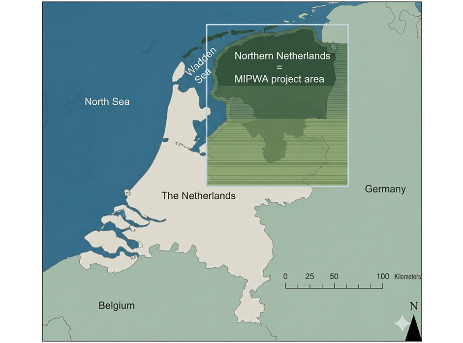
Technical development supported 17 Dutch water management authorities in jointly building a high-resolution regional groundwater model and interactive planning tool, enabling shared, consensus-based decision-making on water management policy for the northern Netherlands
The interests of the different parties involved in regional water management in the Netherlands, provinces, drinking water companies, water boards and municipalities, often conflict, making it difficult to reach shared decisions on groundwater and surface water regimes. To address this challenge, 17 water management stakeholders in the northern Netherlands joined forces, for the first time in the Netherlands, to develop a large-scale, high-resolution decision-support tool for groundwater-related issues, through the «Methodiekontwikkeling voor Interactieve Planvorming ten behoeve van Waterbeheer» (MIPWA — Methodology for Interactive Planning for Water Management) project.
The project built a groundwater model reference database at 25×25 m resolution, covering the combined management area of the participating authorities (145 × 167 km), together with an impulse-response database and the user-friendly interactive modelling interface iMOD. Base data were first processed into model input, supplemented with information from existing groundwater models, and then refined through an extensive joint analysis involving modellers, area experts and the commissioning authorities. The model was further calibrated using more than 8,000 measured groundwater level and hydraulic head locations, through both steady-state and transient calibration.
Strong emphasis was placed on process facilitation to ensure the tool would be adopted across the participating organisations. The project began with a stakeholder and force-field analysis, followed by numerous workshops in which conceptual choices for the model instrumentarium were made jointly by the stakeholder group, based on options presented by modelling experts from various research institutes and consultancies. This collaborative approach strengthened cooperation between participating organisations and created a level playing field for environmental planning processes. The resulting instrumentarium can be applied to a range of studies, including the determination of desired groundwater and surface water regimes (GGOR), planning studies, permitting, and scenario development for structural visions and water management plans.
The project contributed to strengthening interactive, consensus-based water management planning in the Netherlands by:
- Developing a high-resolution regional groundwater model and reference database for the northern Netherlands, jointly owned by 17 water management stakeholders.
- Creating the interactive modelling tool iMOD, enabling stakeholders to visualise, analyse and directly recalculate model input and output.
- Calibrating the model against more than 8,000 measured groundwater locations for both steady-state and transient conditions.
Facilitating a stakeholder-driven, workshop-based process for building consensus on model choices and their policy application.
Project cost
€ 2 million (initial development phase)
Implementation Period
2005–2007 for the development of the first model version (MIPWA 1.0).
The consortium has continued ever since, maintaining, updating and applying the model in regional water policy and planning to this day.
Partners
- Provinces: Groningen, Fryslân, Drenthe, and Overijssel
- Water boards (waterschappen): Overijssel, Drenthe and Fryslân
- All municipalities in the project area
- Vitens
- WMD Drinkwater
- Waterbedrijf Groningen
- Land Development Service (DLG)
- TNO (Geological Survey of the Netherlands)
- Deltares
- Wageningen Environmental Research
Donante
Países
 Netherlands